Still not in from the cold: Latest batch of winter weather could bring 2 to 4 inches of snow Thursday
Published 10:44 am Tuesday, January 28, 2014

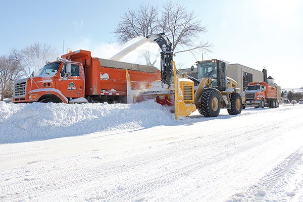
Trucks line up to haul away snow on Second Street Northeast Monday morning in Austin. — Matt Peterson
Wind, cold, snow: None of them are giving up in Austin.
Tuesday’s forecast calls for breezy conditions, with a high of 2 below 0, according to the National Weather Service in La Crosse, Wis. Tuesday’s overnight low could dip to 9 below, before the snow comes back for another visit Wednesday night. Between Wednesday night and Thursday, the area could receive between 2 to 4 inches of snow, said NWS meteorologist Zack Taylor.
Much of the region has been struck by recurring rounds of cold, wind and snow every few days.
“We’ve been really cold the last six weeks or so because the general weather pattern has been allowing arctic surges to come in periodically, every few days,” Taylor said.
Sunday night’s weather left many motorists stranded in ditches without visibility. According to Mower County Sheriff Terese Amazi, deputies even used a Humvee in attempt to reach one stranded woman, but still had to get to her on foot. That full report was not yet available.
Though January 2014 isn’t setting temperature records, it is close. The average temperature of 7.6 through Jan. 27 is the 14th coldest on record, and coldest since 2009. The record was set in 1979, with an average temperature of 0.5 degrees. Monday’s high of 7 below was just shy of the 9 below record for Jan. 27. The cold spell has caused propane prices to skyrocket as rural residents struggle to heat their homes, and as natural gas prices crept up, a pipeline explosion in Canada has worsened that situation, too. Mower Freeborn Cooperative Services and other energy suppliers are urging energy consumption.
The frigid conditions aren’t done, either. While temperatures will increase to the teens to low 20s in the next week, that rate is still below average for the area.
“There’s really no strong signal for a significant warm-up, at least through the next seven to 10 days,” Taylor said.


