Area placed in winter storm watch
Published 9:30 am Friday, February 7, 2020
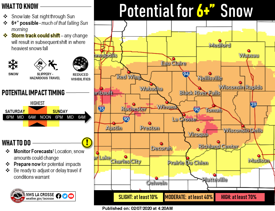
A winter storm watch has been placed on areas of southeast Minnesota and northeast Iowa ahead of a winter storm that is expected to impact the area late Saturday night.
The watch stretches from midnight Saturday through 6 p.m. Sunday. Initially predicted to dump between 2 to 4 inches, the forecast has since been upgraded to a possible 4 to 7 inches by the time everything is said and done, with the added possibility of a wintery mix.
Expect the storm to impact travel as the higher amounts are expected to fall along the Interstate 90 corridor.
The snow is predicted to start at around 9 p.m. Saturday with most of it forecast to fall after midnight, into early Sunday morning.
Temperatures will hover at around 29 degrees throughout the day Sunday with a low of 5 degrees in the overnight hours.