Drought expected through October
Published 9:53 pm Thursday, August 9, 2012

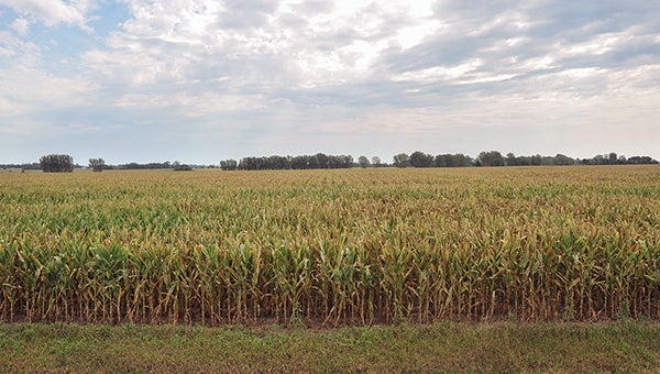
Farmers are playing a tense wait-and-see game with corn crops this year. There may still be time to save the struggling crops, but it will require more rain soon. -- Eric Johnson/photodesk@austindailyherald.com
Editor’s note: This story originally appeared in the Aug. 5 print edition of the Herald. For the complete series, click here.
Don’t get too used to the recent rainfall.
National Weather Service Meteorologist John Wetenkamp said forecast models show the Austin area remaining dry and abnormally warm through the end of October.
“There really are no big changes here on the horizon to help alleviate these drought conditions,” Wetenkamp said.
One of the best chances for precipitation, according to Wetenkamp, was during the weekend, and there are no significant weather systems expected in the foreseeable future.
“We’re not seeing any real change in this pattern,” he said.
The Austin area, like much of the Midwest, is already dry-caked in drought, and July only saw about 1.36 inches of precipitation, compared to the July average of 4.12 inches, which dates back to 1937.
“It’s significantly drier than what we would see on average,” Wetenkamp said.
July also was warmer than normal. The average high temperature was 88.8 degrees in July of 2012, according to NWS data. Since 1937, the average high in July has been 82.7. The average low temperature was 64.9 in July of 2012, compared to a historic average of 60.
While July numbers are not yet officially tallied at the Midwest Regional Climate Center in Illinois, the period of January through June is the warmest ever recorded in southeastern Minnesota. That data dates back to 1895. A big factor in that was the unusually warm spring.
Still, Mike Timlin, MRCC regional climatologist, is hesitant to say that is evidence of climate change over a century.
“It’s really hard to do any trend analysis on extremes,” Timlin said.
What is evident, however, is that much of the Midwest is experiencing extremes this year.
According to MRCC, “More than 1,900 daily record high temperatures were set across the region with daily counts topping 100 on each of the first eight days of the month. Records peaked on the fifth through the seventh with each day having over 300 record highs. Statewide counts of daily temperature records for the first 10 days of July ranged from 99 in Minnesota to 367 in Missouri. At least one station in each of the nine Midwest states set or tied an all-time record high temperature.”
Timlin added that Minnesota winters have become increasingly warmer, as well, while summers are slightly warmer. Part of that, however, could be caused by urbanization near sample sites. Concrete buildings and pavement will hold heat for a longer period of time.
Though it may seem as if extreme patterns — hard rainfalls followed by long droughts — are becoming increasingly present, some aren’t so sure. Many remember severe droughts in 1988 and 1955. Timlin added that the 1920s and 1930s were riddled with extreme climate changes, as well.
—Reporter Matt Peterson contributed to this report.
Least amount of precipitation from January through June
(Nine southeastern counties in Minnesota)
1936 = 12.5 inches
2012 = 13.55 inches
1934 = 13.66 inches
Highest avg. temperature from January through June
(Nine southeastern counties in Minnesota)
1921 = 55.5
2012 = 56.8
— Source: Midwest Regional Climate Center


